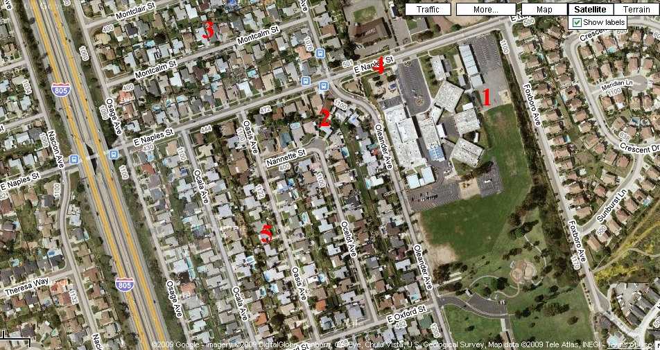
 This is an image from Google Maps, showing the Points of Congruity.
Mystery Aerial Photograph
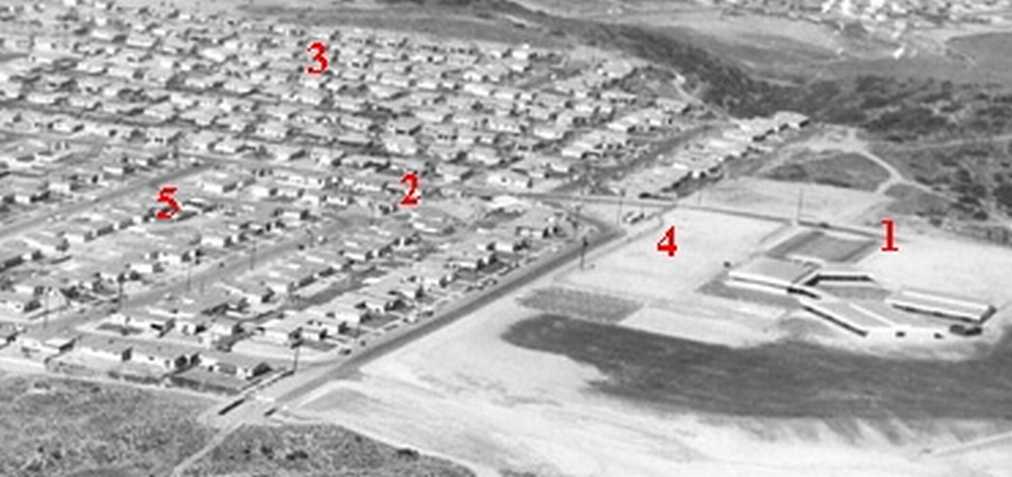
John Fry posted on his web site some pictures of the San Diego area taken by Howard Rozelle. Sometimes he asks viewers to help identify the area. This photograph is labeled "Mystery Aerial". One person thinks it is of the San Carlos area showing Pershing Junior High/Middle School. I thought so too, at first, but now I believe it shows the area around the Chula Vista Boys and Girls Club. I have numbered some comparision points (Points of Congruity) and listed them below the photographs.
This is a enlarged copy of a portion of the Howard Rozelle photograph. You can see the original on John Fry's website by clicking here.
 This is an image from Google Maps, showing the Points of Congruity.

Points of Congruity1. Angled buildings.
2. Ocelot Ave. turns a corner and becomes Nannette St.
3. Streets at same right angle to other streets.
4. Oleander Ave. makes a little jog and crosses E. Naples St.
5. Streets at same right angle to streets in point number three.
6. (Not numbered on photos) Osage St., the one next to the freeway on the Google Maps image, continues across E. Naples St. You can't see this on my enlarged portion of the Rozelle photo, but it is in the original, if you enlarge it enough!
What do YOU think? Are they of the same place (different time)? Am I right? Am I?

Want to contact me about something? 